Southie History Lesson: Fort Point

If you enjoy walking, one of the best places to go for a walk is one of Southie’s most interesting neighborhoods – Fort Point. But why is Fort Point called Fort Point? Let’s find out together in this Caught in Southie History Lesson!

There are fantastic old maps of this area. In this awesome map of Boston Harbor from 1770 you can see Boston and you can find Dorchester Neck and Castle William. Dorchester Neck will become more filled in and “turn into” what we think of as traditional South Boston. Castle William eventually becomes Castle Island. However, there is a lot of water where Fort Point should be!
By 1855 Boston looks more like what we think it should look like:

During its early days, Boston as you know, was geographically a lot smaller. There was a hill in Boston that jutted into the harbor, making a “point” and it became known as Fort Hill because, since it was higher than the surrounding land, cannons were placed there to defend Boston and the harbor, hence “fort hill” on what was a “point” of land. Eventually the hill was flattened and the land around it expanded but the name stuck. On this map you can see the area known as Fort Hill, but by the time this map was drawn the “point” was already long gone:

While the strategic position, the original hill, and even the point no longer exist, the name does. Fort Point today is a vibrant part of South Boston with artists, residents, restaurants, biotech and thriving neighborhood organizations like Friends of the Fort Point Channel, FPAC (The Fort Point Arts Community) and the Fort Point Neighborhood Association. Boston By Foot even has a special Fort Point private tour you can book so you can learn and explore this part of Southie even more!
Let us know if you go!
Did you know?
Did you know that the Fort Point Neighborhood is now a historic landmark district It’s one of nine historic landmark districts in the City of Boston. In the early part of the 20th century, the Boston Wharf Company constructed many boxy, brick buildings that were homes to factories and warehouses. The the buildings exist pretty much the way they did way back in the early 1900’s. That preservation is due to the Boston Landmark Commission!
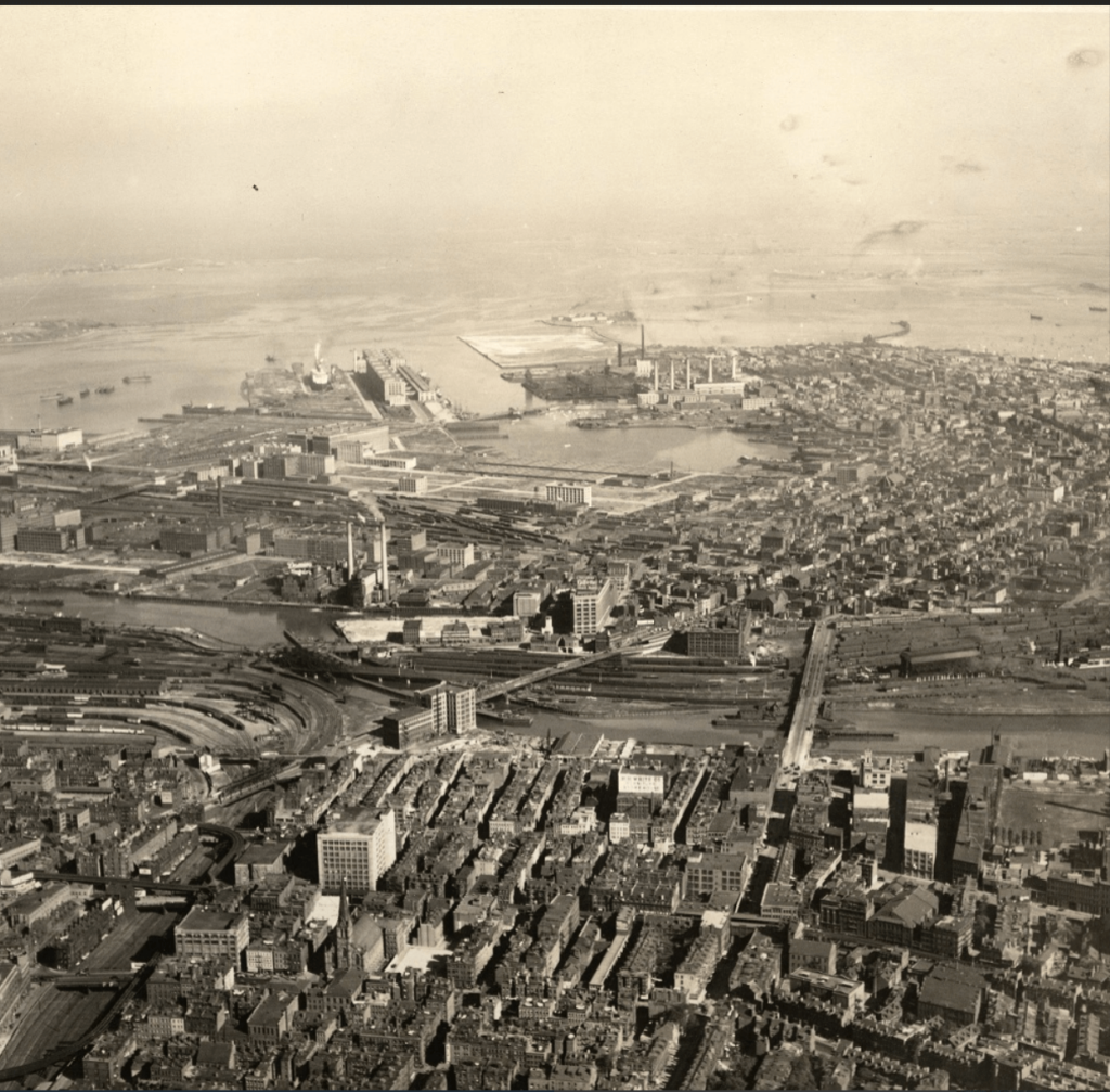
Aerial image of Fort Point from 1925 via City Planning Board/Boston Landmarks Commission/Boston City Archives

Summer St. from “A” St. Bridge, approximately 1898-1907 via Boston Wharf Company/Boston Public Library.
Main image via Boston Preservation Alliance
Lower End homeowner since 2005. Mom of three BPS kids. Friend to all except those who don’t clean up after their dogs and/or who put their trash out in kitchen bags (seriously, people, it’s not that hard to use a barrel). Queen of the Nerds (okay that one is only in my dreams).
Align with Aidan: Meet the Studio78 Instructor Building Community One Class at a Time
Southie History Lesson: The Donald McKay Clipper Ship Monument at Castle Island
Fourth of July + Boston 250 Celebrations in and around the Neighborhood